Where is Hawkins Located on a Real Indiana Map?
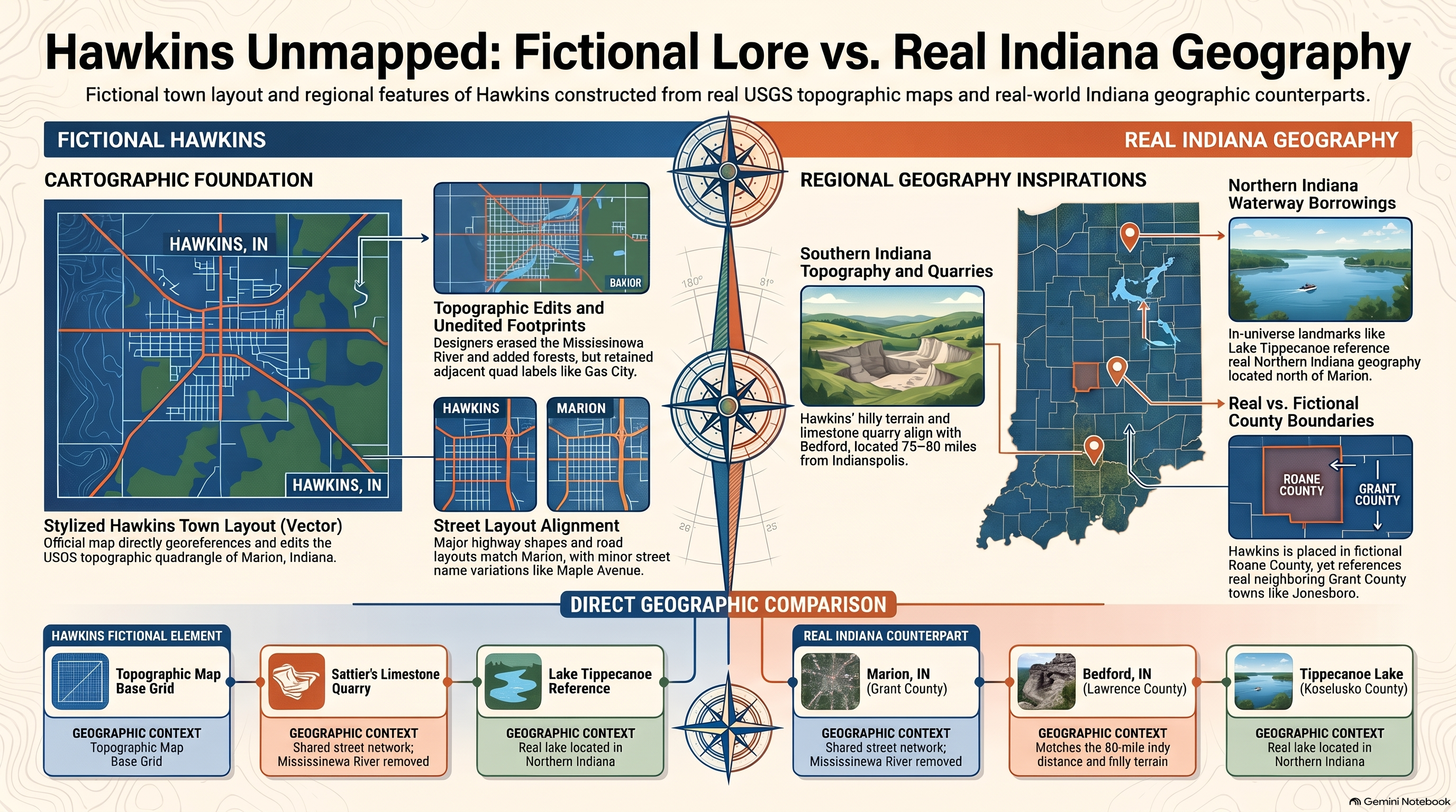
1. The Myth of Hawkins: Fictional vs. Real Indiana Cartography

One of the most frequent inquiries generated by contemporary pop culture in the United States concerns the precise physical coordinates of Hawkins, Indiana. Within the narrative universe created by the Duffer brothers, Hawkins is depicted as a quiet, unassuming midwestern municipality nestled within the fictional Roane County. However, exhaustive examination of official state maps and county gazetteers reveals that no such county or town exists within the actual cartographic framework of Indiana.
At HcM, analyzing fictional settings through a rigorous spatial lens exposes how television production design merges real geographic archetypes to craft believable isolation. While actual Indiana geography features dense industrial corridors, agricultural grids, and regional hubs like Indianapolis or Bloomington, Hawkins was deliberately designed as a composite archetype. It borrows the mid-century aesthetic, railway access points, and quarry topography typical of the American Midwest without tying itself to real municipal boundaries.
"Fictional cartography relies on plausible isolation; by placing a high-security federal installation inside a sleepy midwestern county, the narrative manufactures immediate strategic vulnerability."
— HcM Pop Culture Geography Board
This deliberate ambiguity allows the creators to subject the town to extraordinary geopolitical and paranormal pressures without clashing with real municipal records. Understanding this spatial fiction is the first step toward evaluating how physical infrastructure dictated the survival strategies of local residents during systemic crises.

2. Roane County and Midwest Isolation Dynamics

The strategic geography of Hawkins is defined primarily by its isolation. Roane County functions as a controlled spatial bubble, bounded by dense pine forests, state parks, and abandoned limestone quarries. This topography mirrors real-world regions in southern Indiana where karst topography, sinkholes, and wooded highlands naturally separate rural communities from major interstate arteries.
Such isolation serves a vital structural purpose for both storytelling and security analysis. In classical military geography, remote communities lacking redundant transit corridors are highly susceptible to total containment. When federal agencies or covert factions establish restricted zones—such as the Hawkins National Laboratory—local civilian traffic can be easily monitored, rerouted, or suppressed at regional checkpoints.
Furthermore, this structural isolation directly connects to broader themes of infrastructure vulnerability explored across HcM digital series, such as Byzantine military logistics . Just as ancient fortresses depended on secure communications networks, Hawkins' reliance on single-lane county roads made it a tactical bottleneck when interdimensional anomalies breached the municipal perimeter.

3. Spatial Mirroring: Mapping the Upside Down Infrastructure
A defining feature of the cartography in Stranger Things is the existence of the "Upside Down"—an exact spatial mirror of Hawkins existing in a decayed, toxic parallel dimension. Unlike mystical realms in traditional fantasy, the Upside Down obeys rigid cartographic rules: every street, residential building, commercial structure, and utility pole perfectly corresponds to its real-world counterpart in Hawkins.
This 1:1 spatial mirroring transforms ordinary municipal infrastructure into a tactical liability. When biological spores, tunnels, and predatory entities expand beneath the town, their underground network follows pre-existing geological fault lines and municipal sewer easements. The physical layout of the Starcourt Mall demonstrates how modern consumer architecture could be exploited by covert operations to mask subterranean invasions.
From an analytical perspective, studying this mirroring allows us to construct conceptual maps where civilian zoning laws intersect with paranormal containment zones. The alignment between surface commerce and subsurface danger highlights how vulnerable modern town planning is when subjected to multi-dimensional threats.
4. Tactical Vulnerability and Federal Containment Failures
The operational failure of federal agencies in Hawkins stems from poor contingency planning against localized geographic spreading. When the primary rift at the Hawkins National Laboratory expanded, standard military doctrine relied on rigid perimeter lockdown rather than mobile subterranean defense.
Because Roane County featured limited evacuation routes, any serious breach immediately choked arterial roadways, preventing civilian flight and trapping military assets inside a localized kill zone. Similar infrastructural collapses have been analyzed in other historical contexts, such as the Siege of Constantinople , where defending a fixed perimeter without secure supply corridors inevitably leads to catastrophic failure.
Ultimately, the geography of Hawkins proves that federal secrecy and architectural isolation cannot protect a community when interdimensional boundaries collapse. Proper regional planning requires redundant communication lines and decentralized emergency response protocols—lessons applicable to both historical empires and speculative fiction.
5. Institutional Legacy & Sources
Examining fictional settings like Hawkins through cartographic and geopolitical frameworks enriches our understanding of spatial design, narrative world-building, and infrastructure dependency. At HcM, we continue to bridge the gap between popular culture, historical geography, and tactical analysis.
Academic & Cartographic Sources
- Duffer Brothers, Matt & Ross. Stranger Things: Official Production Design and Conceptual Archives. Netflix Studios, 2016–2025.
- Indiana Geological and Water Survey. Topographical Mapping and Karst Terrains of Southern Indiana. Indiana University, 2020.
- Haldon, John. State, Army and Society in Byzantium: Approaches to Military, Social and Administrative History. Variorum, 1995.
- Treadgold, Warren. Byzantium and Its Army, 284–1081. Stanford University Press, 1995.
- Vance, Norman. The Fictional Atlas: Spatial Representation in Modern Narrative Media. Academic Press, 2018.

Byzantine Theme System: Military Organization & Administration
Rigorous analysis of the Byzantine theme system, military-administrative restructuring, and provincial governance.

Siege of Constantinople: Naval Tactics & Greek Fire
Detailed technological and tactical analysis of the Second Arab Siege of Constantinople and Greek Fire.

Justinian Reconquest: Economic & Military Impact
Macroeconomic and geopolitical evaluation of Emperor Justinian I's Western reconquest campaigns.