Alexandria Safe Zone Layout: Regional Spatial Geography
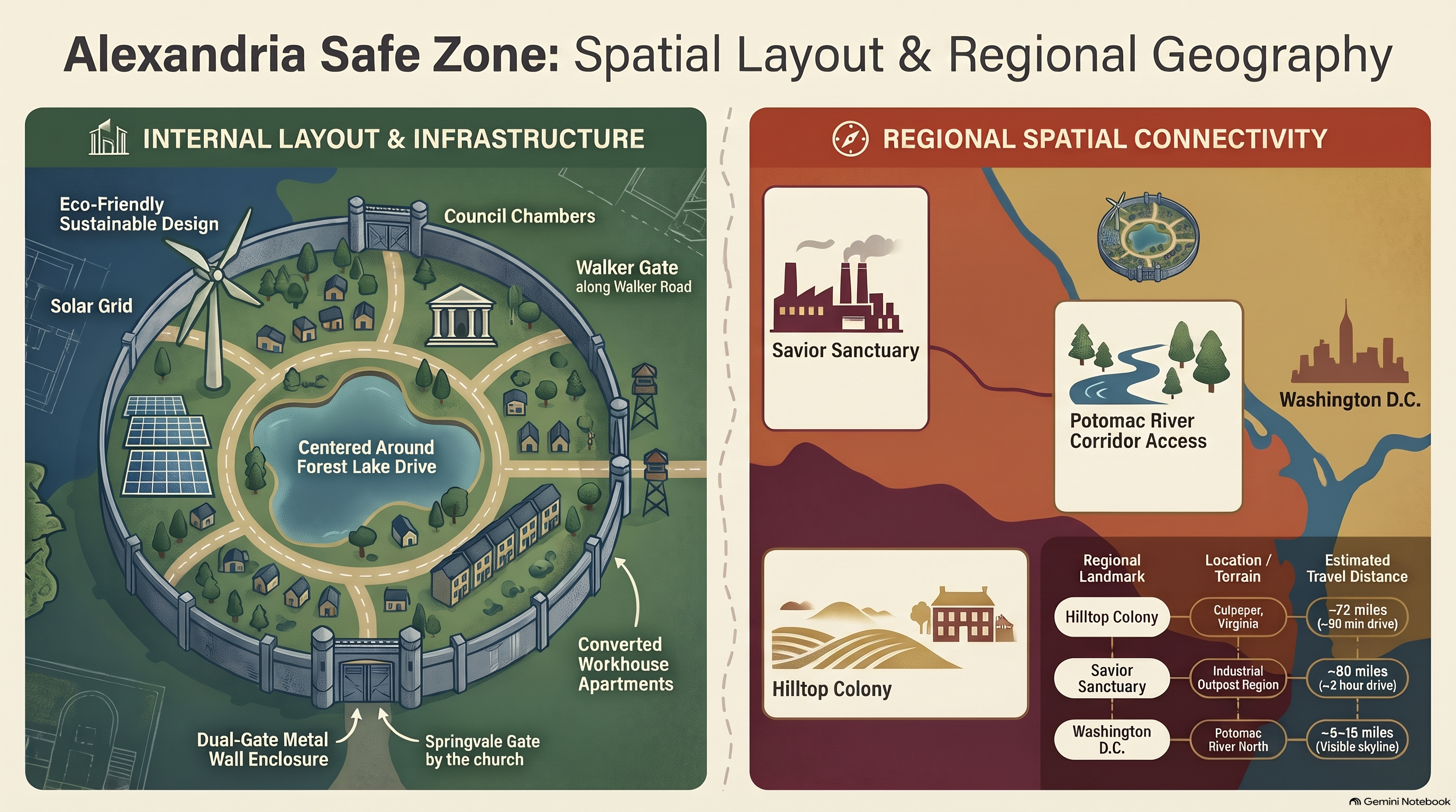
1. Perimeter Architecture and Steel Beam Reinforcements
The security of any surviving community in post-apocalyptic Virginia relies fundamentally on physical barriers. HcM researchers evaluate how Alexandria's initial construction leveraged suburban housing stock enclosed by sheet metal walls. However, structural vulnerabilities necessitated heavy reinforcement using welded steel beams angled inward to absorb kinetic pressure from massive walker hordes.
Managing entry points required strict checkpoint protocols. The main gate serves as the sole vehicular portal, monitored continuously from elevated watchtowers. This design minimizes structural exposure and prevents unauthorized infiltration from rival factions operating across the territorial expansion map .

"A wall is only as enduring as the community willing to bleed in its defense; geometry and steel delay the inevitable, but human vigilance secures the perimeter."
— HcM Tactical Studies Group
Furthermore, perimeter patrols utilize the watchtower grid , ensuring that any accumulation of undead or hostile scouts is flagged before reaching the outer residential fences.
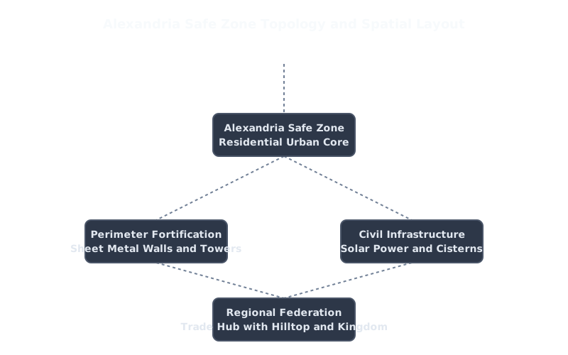
2. Residential Layout and Solar Micro-Grid Infrastructure
Internal spatial organization within Alexandria mirrors pre-collapse upper-middle-class suburban design, featuring two-story residential homes, paved cul-de-sacs, and communal green spaces. This configuration allowed settlers to transition quickly into established housing units without constructing temporary shelters. Energy independence was achieved by integrating rooftop solar arrays and localized battery banks managed through the micro-grid grid .
Sustenance generation within the compound evolved from ornamental lawns into productive agricultural plots. Greenhouses and herb gardens were established between residential blocks to maximize yield efficiency. This agricultural shift aligns with the findings documented in the urban layout analysis , highlighting how secure residential zones transformed into self-sustaining communal hubs.
Water management relied on existing municipal plumbing tied to deep-well cisterns, ensuring continuous supply even during prolonged sieges or trade disruptions imposed by external groups.
3. Regional Logistics and Connection with Hilltop Axis
Geopolitical stability in Virginia required active trade corridors connecting Alexandria with allied settlements. The northern route toward the agricultural stronghold of Hilltop formed the primary economic lifeline of the regional alliance, facilitating exchanges of manufactured metal goods for surplus crops and livestock.
Logistical coordination along this axis was maintained through mounted patrols and mapped supply routes, as detailed in the post-apocalypse regional map . Securing these paths was vital to prevent ambushes by hostile factions controlling adjacent sectors.

Without these interconnected supply lines, individual communities remained vulnerable to isolation and economic coercion, demonstrating the necessity of federalized cooperation across Virginia.
4. Quarry Barriers and Natural Topographical Defense
Topographical features played a decisive role in shaping Alexandria's outer defensive strategy. The presence of natural geological formations, such as deep stone quarries and winding river valleys, provided structural barriers that funneled or trapped massive walker herds before they reached residential perimeters.
Strategic use of these terrain features is explored further within the geopolitical territory map , which outlines how survivor factions leveraged natural geography to establish secure territorial zones.

Ultimately, combining artificial steel fortifications with natural topographical barriers allowed Alexandria to endure as a cornerstone of civilization in the post-collapse American landscape.
5. Institutional Legacy & Sources
The architectural and spatial evolution of the Alexandria Safe-Zone offers profound insights into community survival, defensive urban planning, and territorial federation. Through rigorous cartographic analysis and historical comparison, researchers continue to map the dynamics of post-apocalyptic state formation.
Primary Sources & Analytical Frameworks
Kirkman, Robert. The Walking Dead: Compendium Series. Image Comics, 2006–2019.
Used to map the architectural dimensions, perimeter wall construction, and geographic layout of the Alexandria Safe-Zone in Virginia.
Gimple, Scott M. et al. The Walking Dead Television Continuity and World Building Analysis. AMC Studios, 2010–2022.
Applied to cross-reference visual coordinates of the Virginia community network and evaluate structural defense upgrades.
Prescott, J.R.V. Political Frontiers and Boundaries. Allen & Unwin, 1985.
Consulted as the core methodology to define border friction, checkpoint security, and defensive perimeter planning.
Related Articles & Hubs

Byzantine Empire
Strategic Dossiers on Administration, Military Logistics & Geopolitical History.

Roman Empire: Economic & Military Impact
Macroeconomic and geopolitical evaluation of Roman Empire.