HcM Logo - World History and Maps Portal
HcM

Historical Atlases, Geopolitics & Cartography Hubs

Explore & Discover

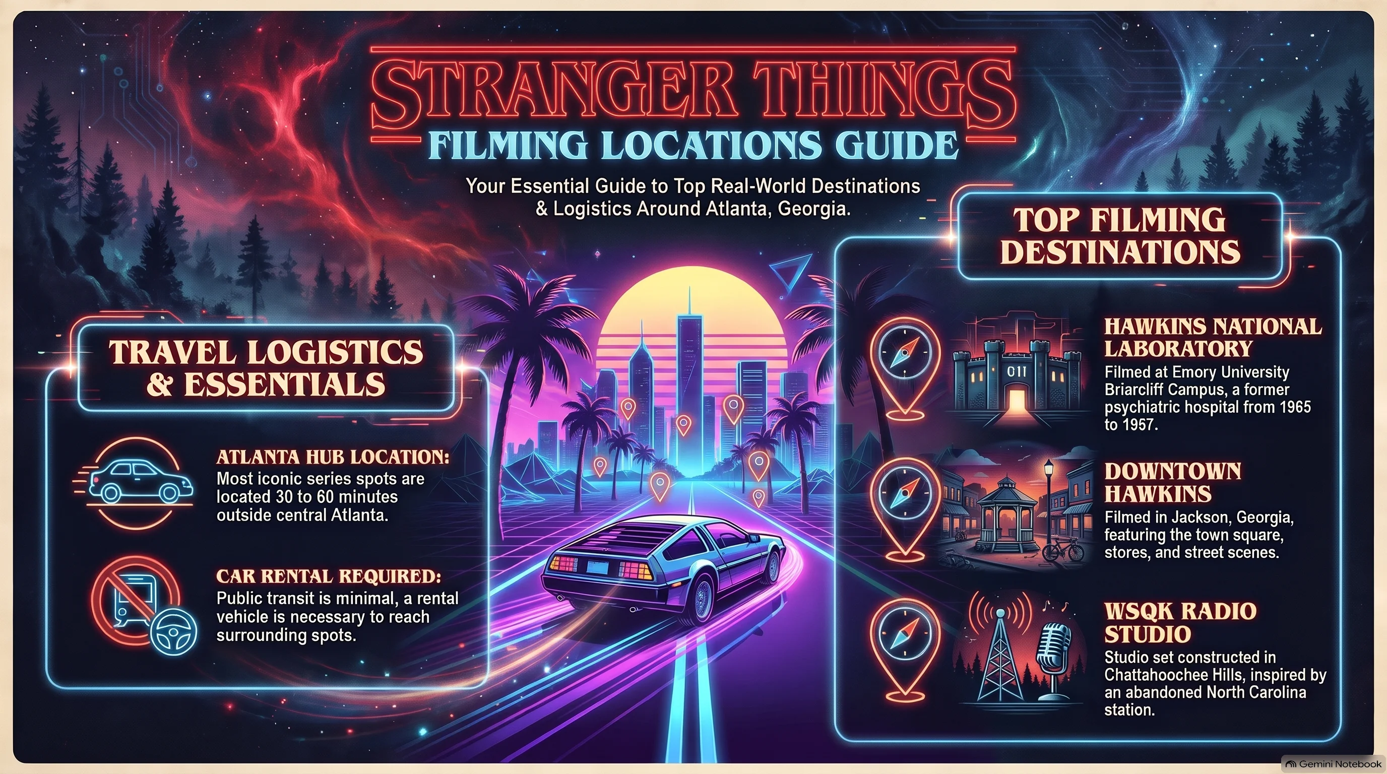
Stranger Things Spatial Geography & Fictional Atlases

Pop Culture Cartography, Subterranean Dynamics & Bio-Containment

Filter:
Media Geography & Narrative Cartography

Delve into meticulous cartographic breakdowns and spatial analyses of Hawkins, Indiana, mapping the subterranean boundaries of Hawkins National Laboratory, dimensional rifts, and federal bio-containment protocols. Each technical dossier juxtaposes fictional worldbuilding lore with rigorous geospatial frameworks to trace the multi-dimensional topography of the Upside Down.

Pop Culture Cartography, Subterranean Dynamics & Bio-Containment
Featured Content & Trending Topics

Primary Knowledge & Cartography Hubs

Explore HcM main cartographic divisions, historical atlases, media worldbuilding, and geopolitical archives.

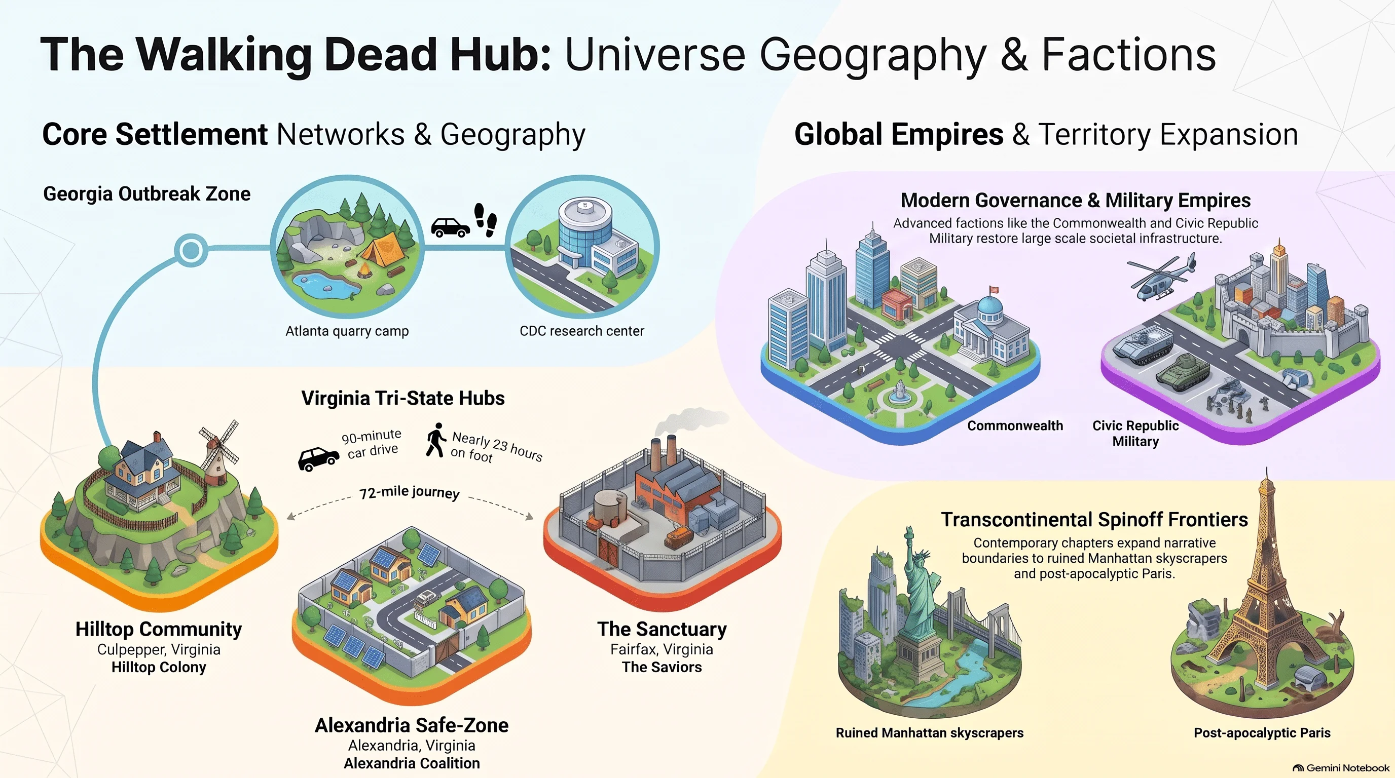
The Walking Dead Survival Maps and Fictional Geopolitical Analysis
The Walking Dead EN
November 2026

The Walking Dead Hub

Trace survival dynamics through spatial maps, territorial shifts, and strategic faction strongholds.

Narrative Cartography, Fictional Geography and Pop Culture Maps
Mother Hub EN
Media & Narrative Cartography

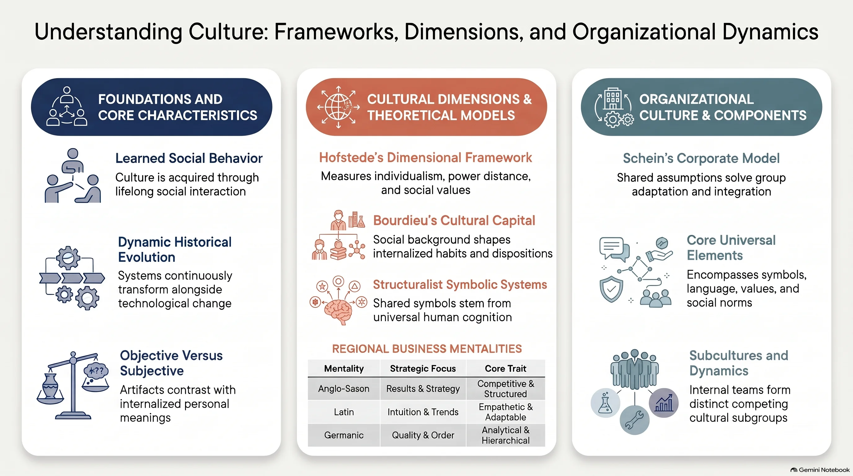
Culture Hub

Uncover narrative cartography, fictional geography, and spatial analysis across pop culture and iconic media franchises.

Explore Hub
Historical Atlases, Military Campaigns and Territorial Evolution Maps
Mother Hub EN
Geopolitical & Chronological

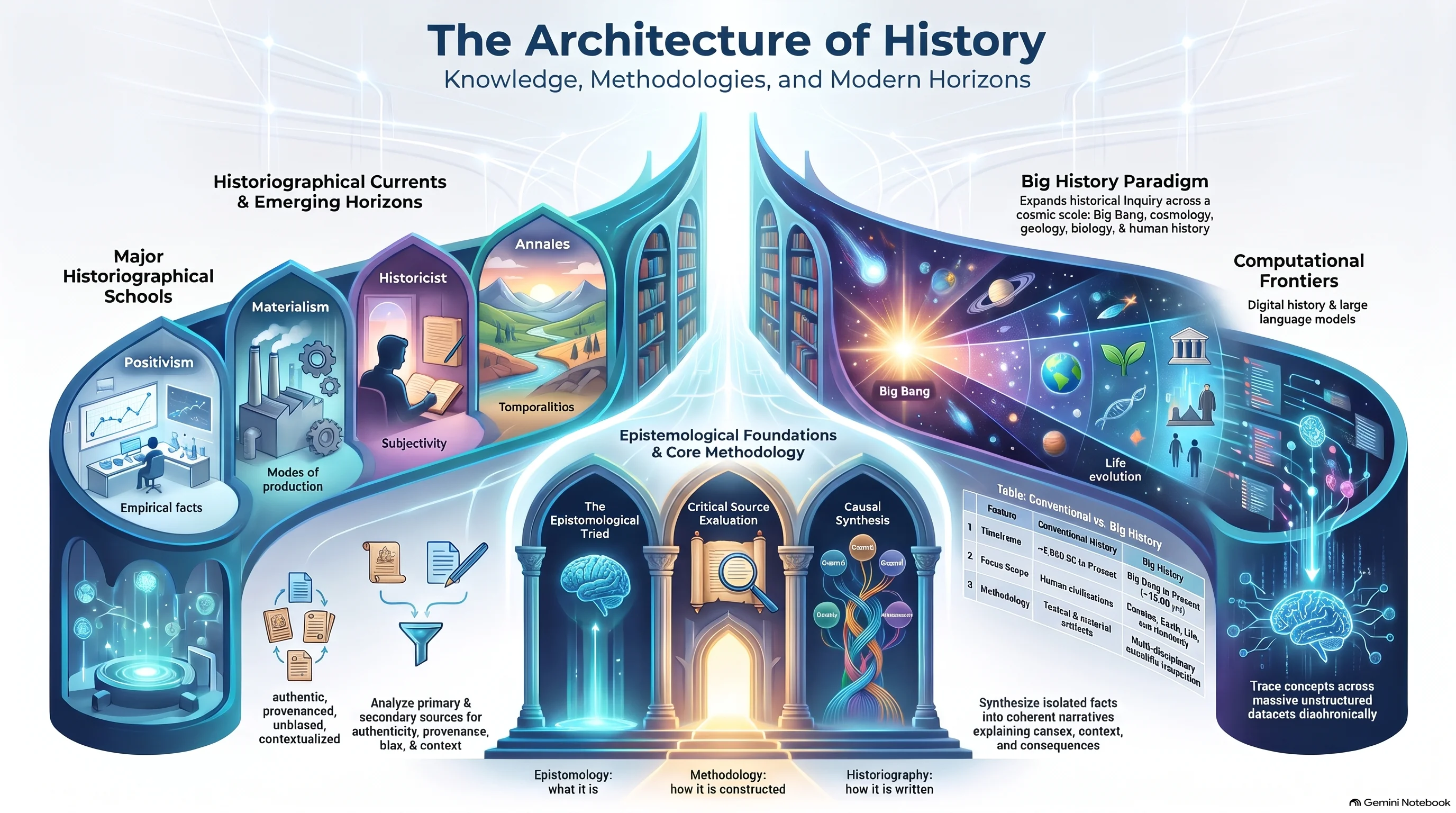
History Hub

Examine comprehensive historical atlases, ancient empires, and centuries of geopolitical transformation

Explore Hub

Technical Acronym Glossary & Definitions

HcM

Digital research portal and cartographic historical archive specializing in geopolitical evolution, institutional statecraft, and spatial pop-culture analysis.

HNL

Hawkins National Laboratory; classified federal energy and defense research facility in Roane County conducting subterranean dimensional experimentation.

DOE

United States Department of Energy; federal executive department exercising primary security and administrative oversight over Hawkins National Laboratory.

Upside Down

Parallel topological dimension featuring an exact 1:1 spatial mirroring of Hawkins physical infrastructure in a decayed biological state.

Rot Vector

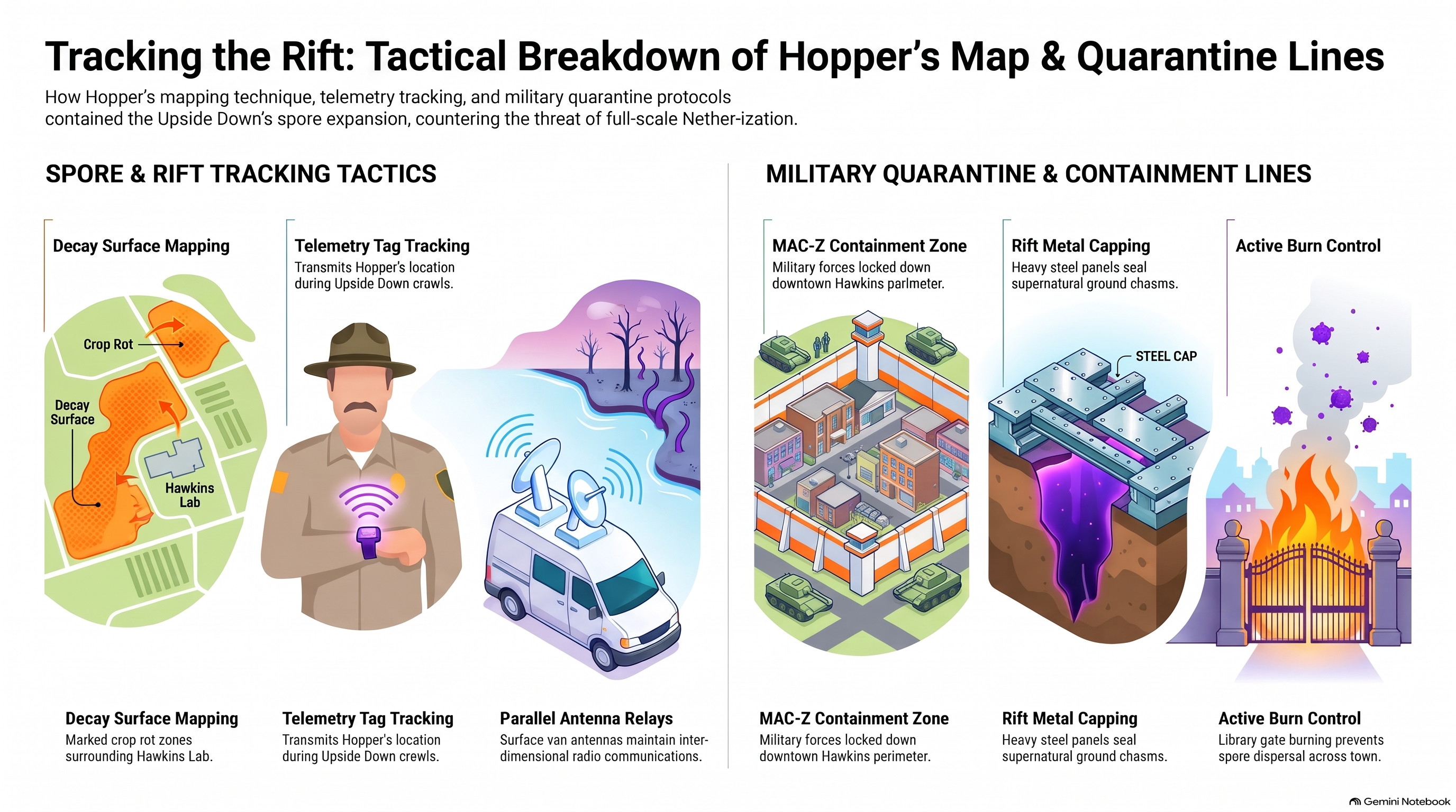
Directional growth path of subterranean organic spores propagating along municipal water tables and topsoil drainage channels.

Four-Gate Intersection

Cartographic rift origin point bisecting Hawkins municipal center along linear geopolitical and seismic fault lines.
Frequently Asked Questions: Stranger Things Spatial Geography & Bio-Containment

Key insights regarding Hawkins topography, subterranean bio-containment lines, and dimensional rifts.

How does Hawkins, Indiana align with real-world midwestern geography?

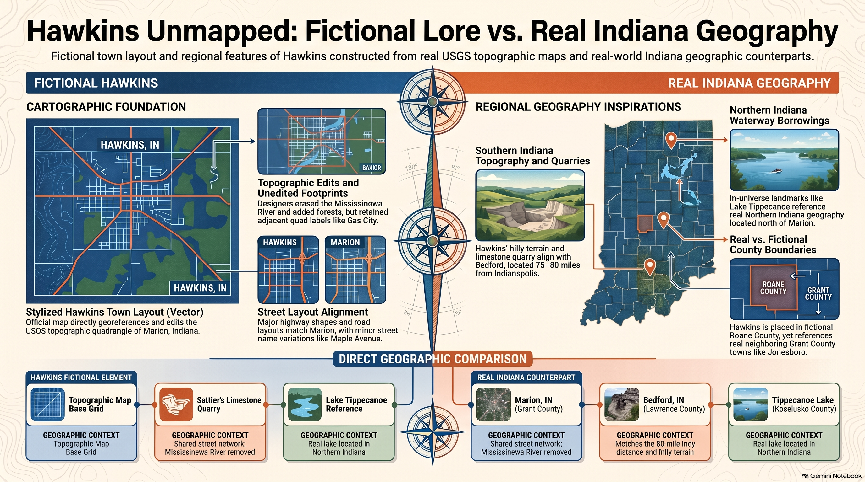
While Hawkins is a fictional municipality, comparative technical analyses map its structural isolation and topography against real-world locations in Roane County and regional Midwest layouts.

What tactical data does Chief Hopper's quarantine map reveal?

Hopper's patchwork map tracks subterranean spore propagation, biological rot vectors spreading along municipal water tables, and federal containment boundaries.

How is the layout of Hawkins National Laboratory structured spatially?

Hawkins National Laboratory (HNL) features classified subterranean research facilities and multi-level underground complexes designed for dimensional experimentation and bio-security containment.

What is the structural relationship between Hawkins and the Upside Down?

The Upside Down acts as an exact 1:1 topological mirror reflecting the physical infrastructure, buildings, and streets of Hawkins in a decayed, spore-infested biological state.