HcM Logo - World History and Maps Portal
HcM

Historical Atlases, Geopolitics & Cartography Hubs

Explore & Discover

The Walking Dead Survival Maps & Settlement Atlases

The Walking Dead Technical & Spatial Archive

Filter:
Survival Geopolitics & Cartographic Atlases

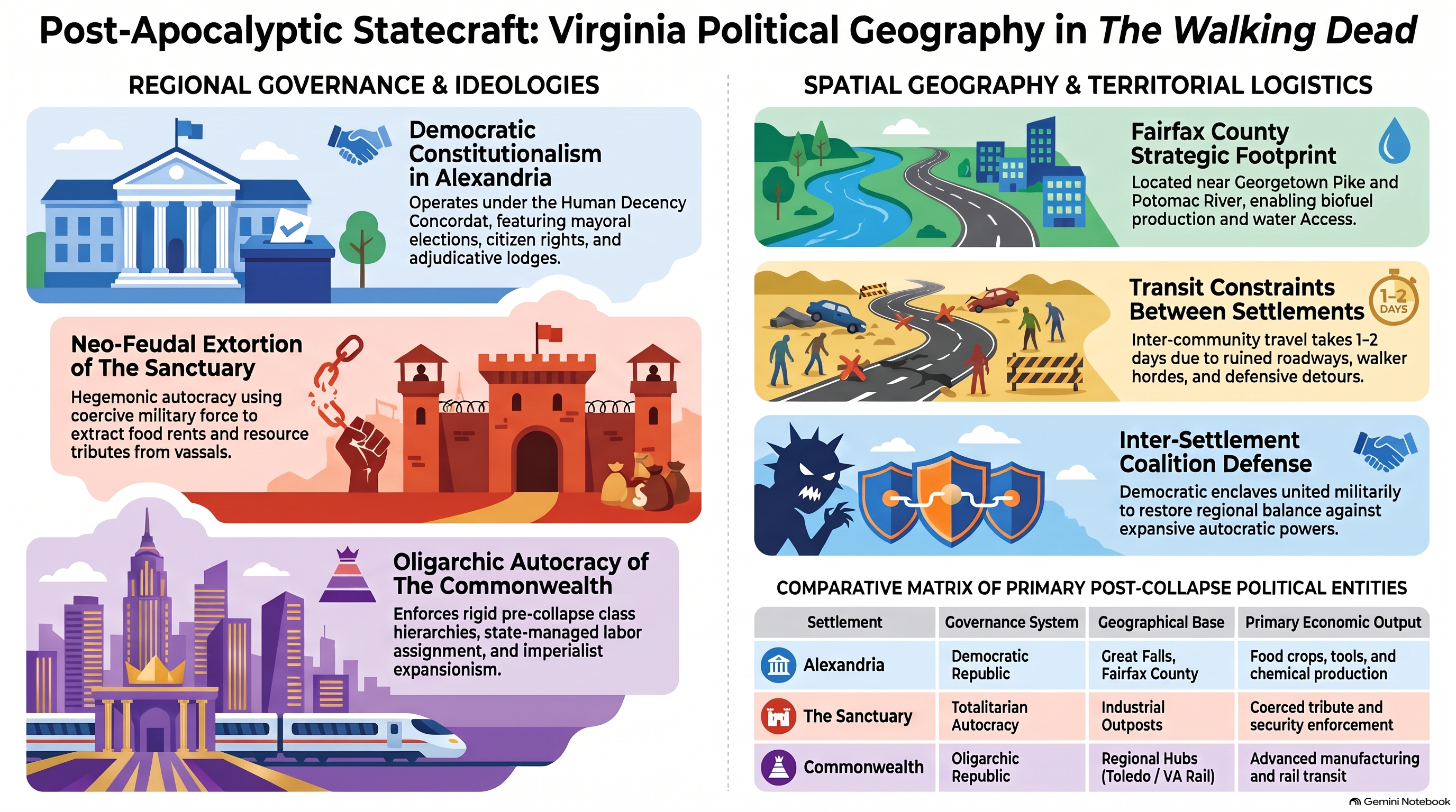
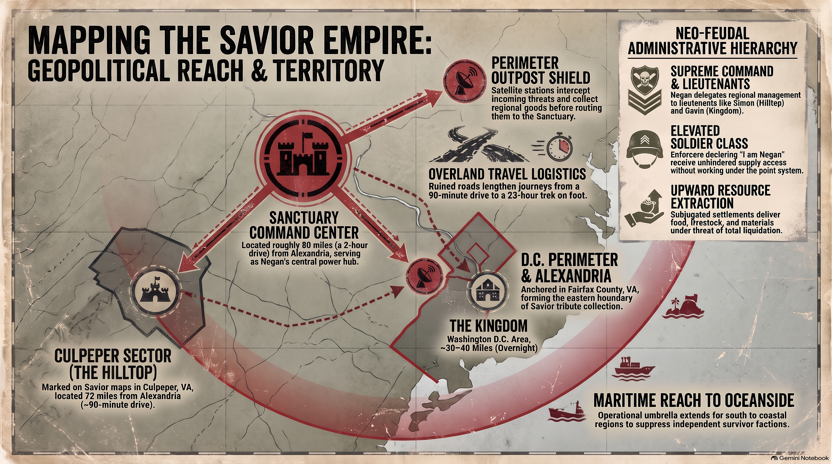
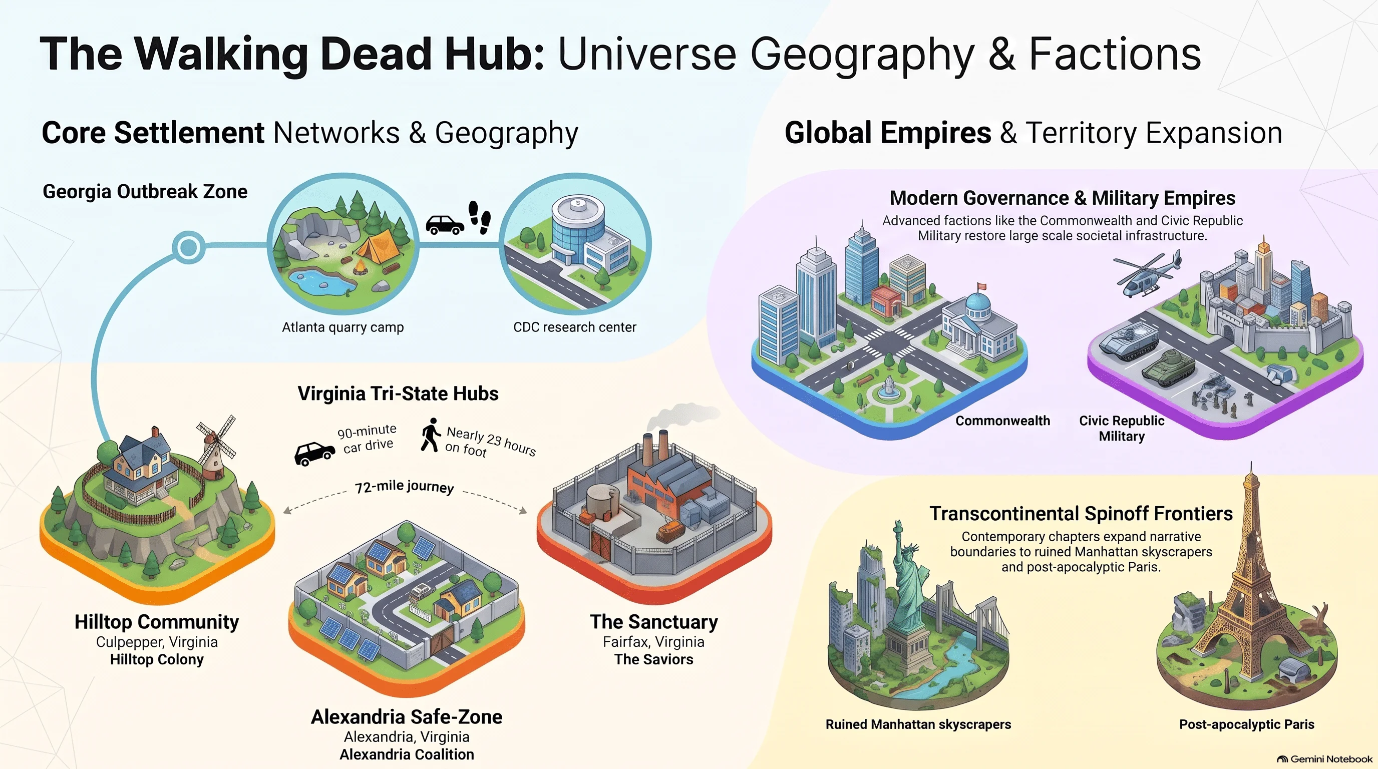
Examine spatial geography, defensive perimeter layouts, and regional geopolitics across the post-apocalyptic United States. From Alexandria Safe-Zone and Hilltop fortifications to Atlanta evacuation grids and classified Civic Republic Military (CRM) sector boundaries, each dossier investigates survival logistics, faction dynamics, and macro-state expansions.

The Walking Dead Survival Maps, Settlement Layouts and Spatial Cartography
Featured Content & Trending Topics

Primary Knowledge & Cartography Hubs

Explore HcM main cartographic divisions, historical atlases, media worldbuilding, and geopolitical archives.

Spatial Geography of Hawkins Indiana, Upside Down Rift Maps and Supernatural Locations
Stranger Things EN
November 2026

Stranger Things Hub

Examine Hawkins spatial geography, subterranean infrastructure, and the structural dynamics of the Upside Down rifts.

Narrative Cartography, Fictional Geography and Pop Culture Maps
Mother Hub EN
Media & Narrative Cartography

Culture Hub

Uncover narrative cartography, fictional geography, and spatial analysis across pop culture and iconic media franchises.

Explore Hub
Historical Atlases, Military Campaigns and Territorial Evolution Maps
Mother Hub EN
Geopolitical & Chronological

History Hub

Examine comprehensive historical atlases, ancient empires, and centuries of geopolitical transformation

Explore Hub

Technical Acronym Glossary & Definitions

HcM

Digital research portal and cartographic historical archive specializing in geopolitical evolution, pop culture spatial analysis, and institutional statecraft.

CRM

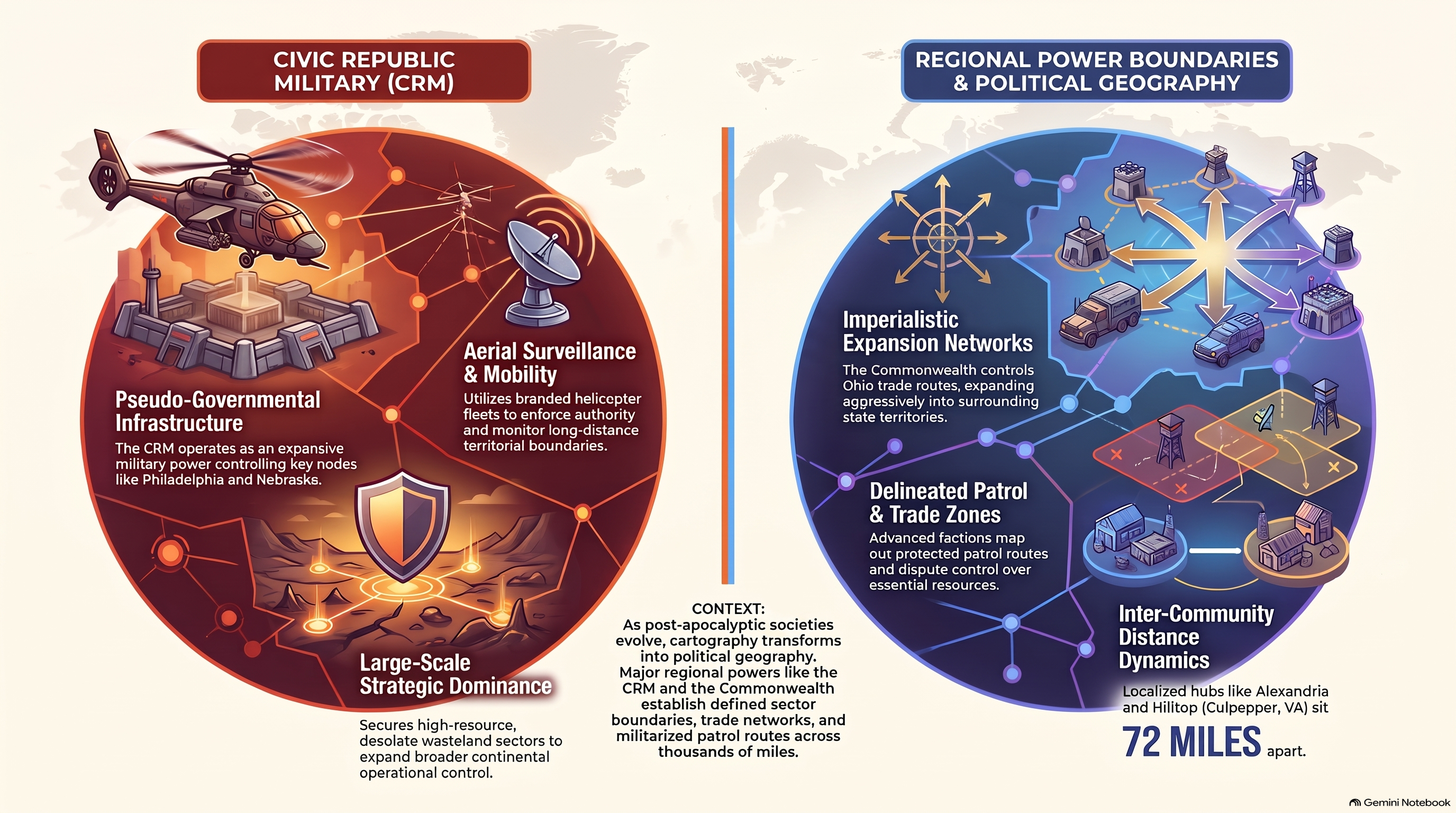
Civic Republic Military; the classified military apparatus enforcing continental sector boundaries and strategic aerial logistics grids across post-apocalyptic North America.

ASZ

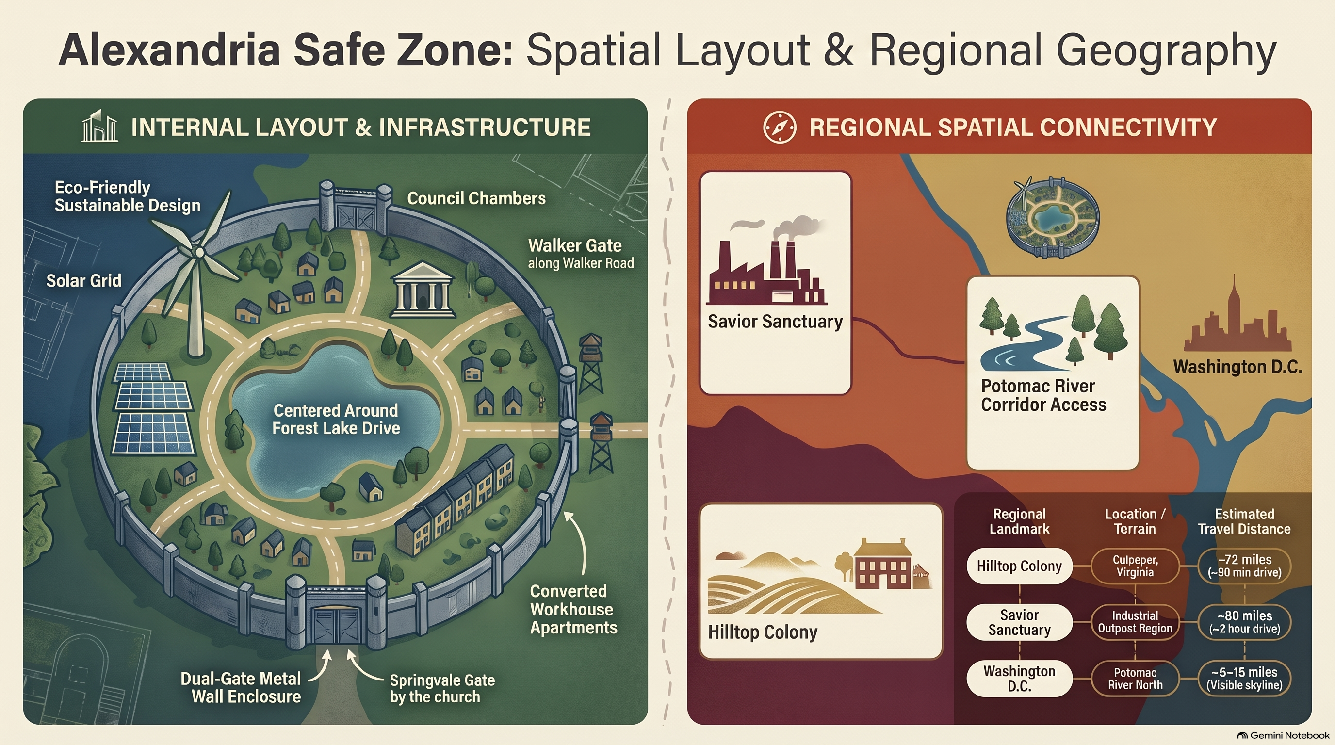
Alexandria Safe-Zone; a walled suburban enclosure in Virginia featuring reinforced sheet-metal perimeters and localized solar micro-grid power systems.

CDC

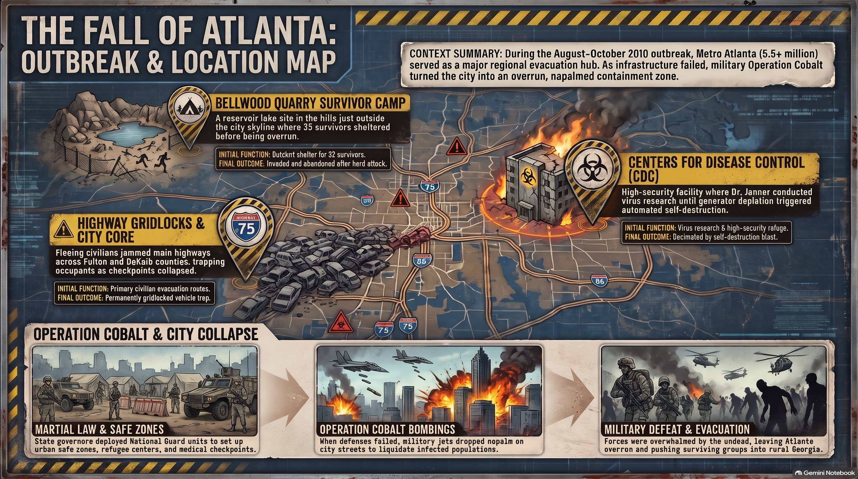
Centers for Disease Control and Prevention; the primary scientific research facility in Atlanta serving as the initial epicenter of outbreak containment analysis.

Culling Operations

Large-scale military maneuvers designed to actively herd, redirect, and neutralize massive walker migrations to secure territorial perimeters.

Tributary Network

An economic extraction framework where peripheral agrarian communities trade production yields in exchange for protection against external raiders and horde pressure.

Frequently Asked Questions: The Walking Dead Spatial Geography & Geopolitics

Key insights regarding post-apocalyptic settlement layouts, military sector boundaries, and defensive perimeters.

How are Alexandria Safe-Zone and Hilltop Colony defensive perimeters engineered?

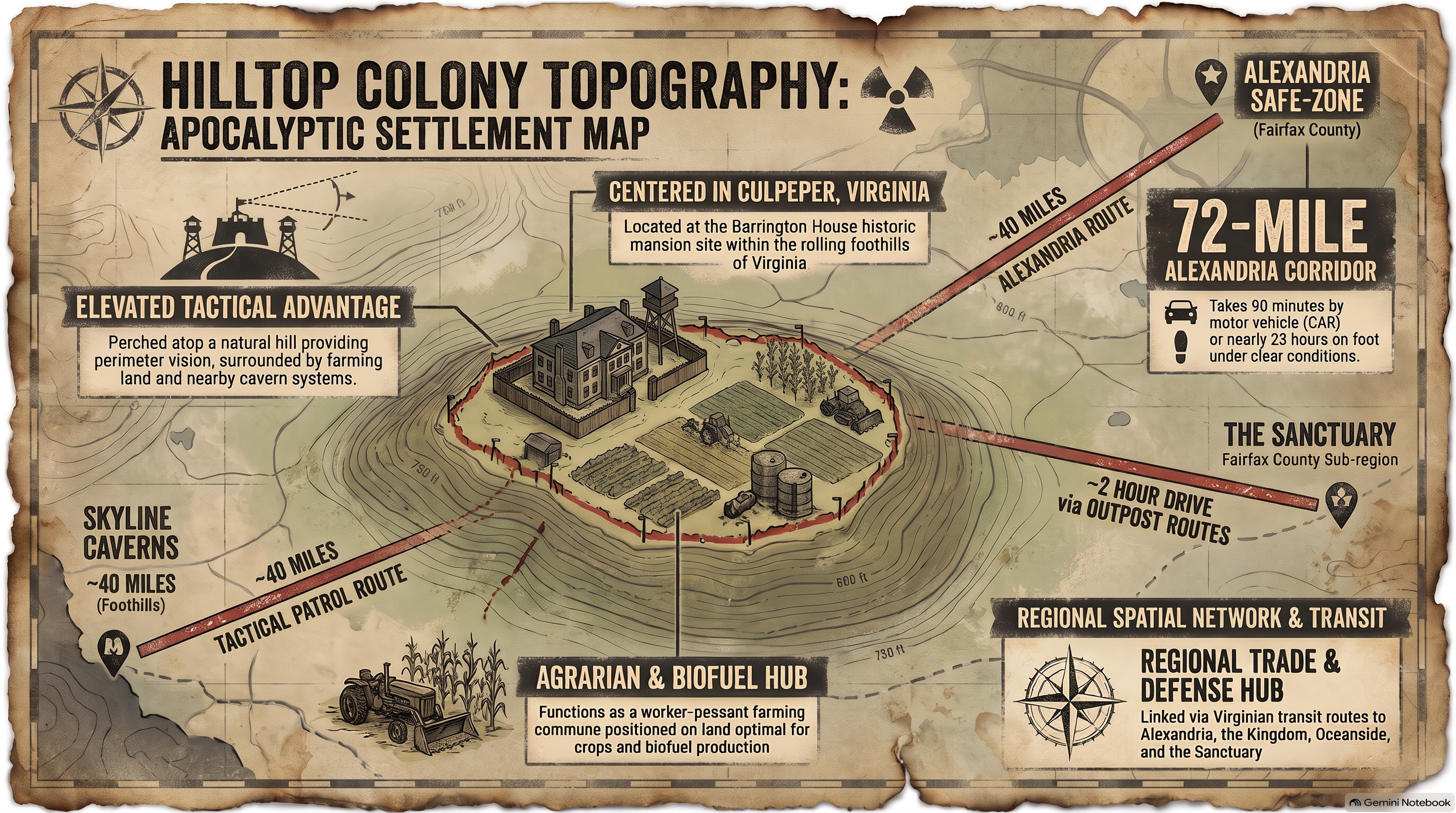
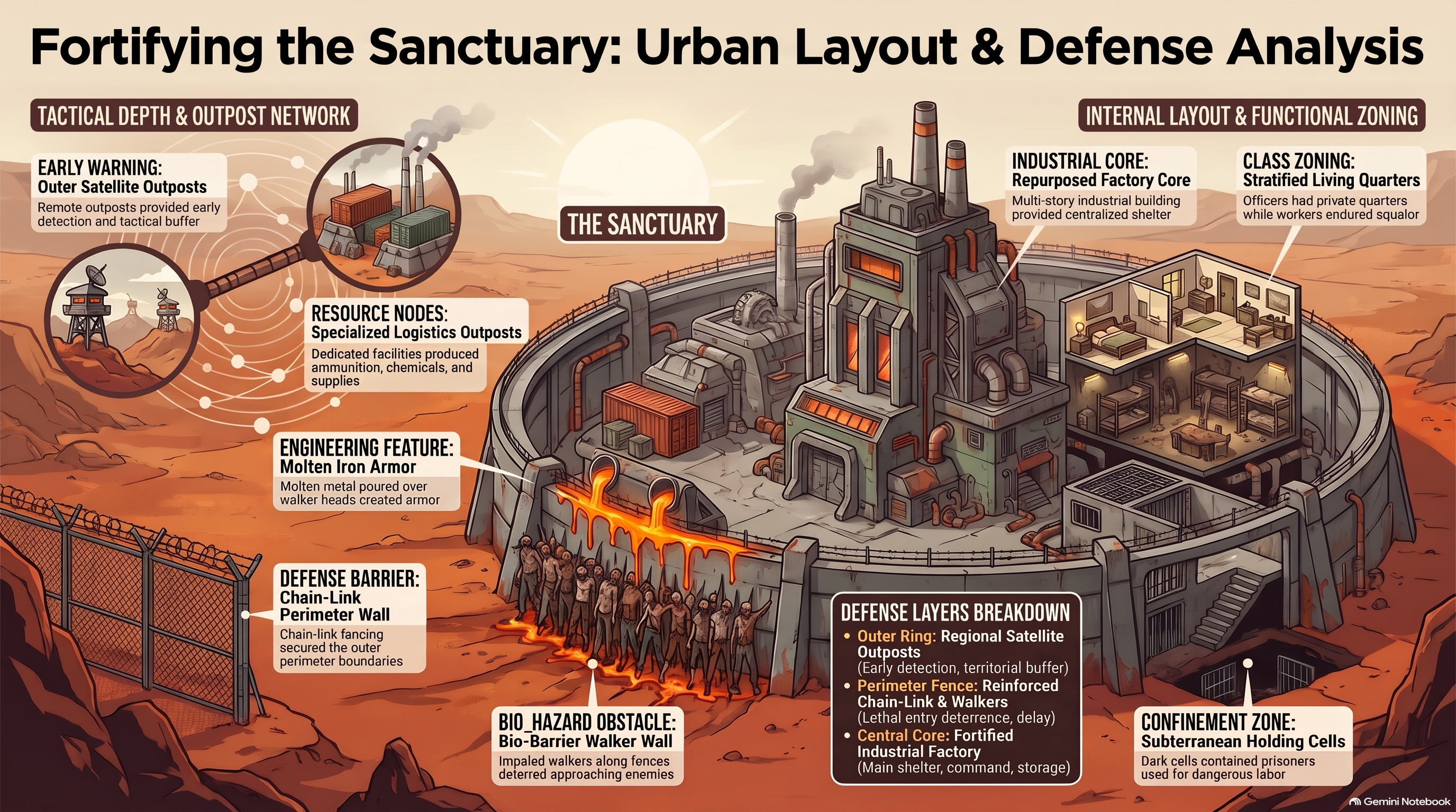
Alexandria relies on reinforced steel-plate walls integrated into preexisting suburban housing structures, while Hilltop utilizes elevated terrain, natural ridge defense, and heavy timber palisades.

What role does the Civic Republic Military (CRM) play in continental geopolitics?

The CRM operates as a macro-state military force enforcing strict sector boundaries, managing aerial logistics grids, and conducting classified culling operations across North America.

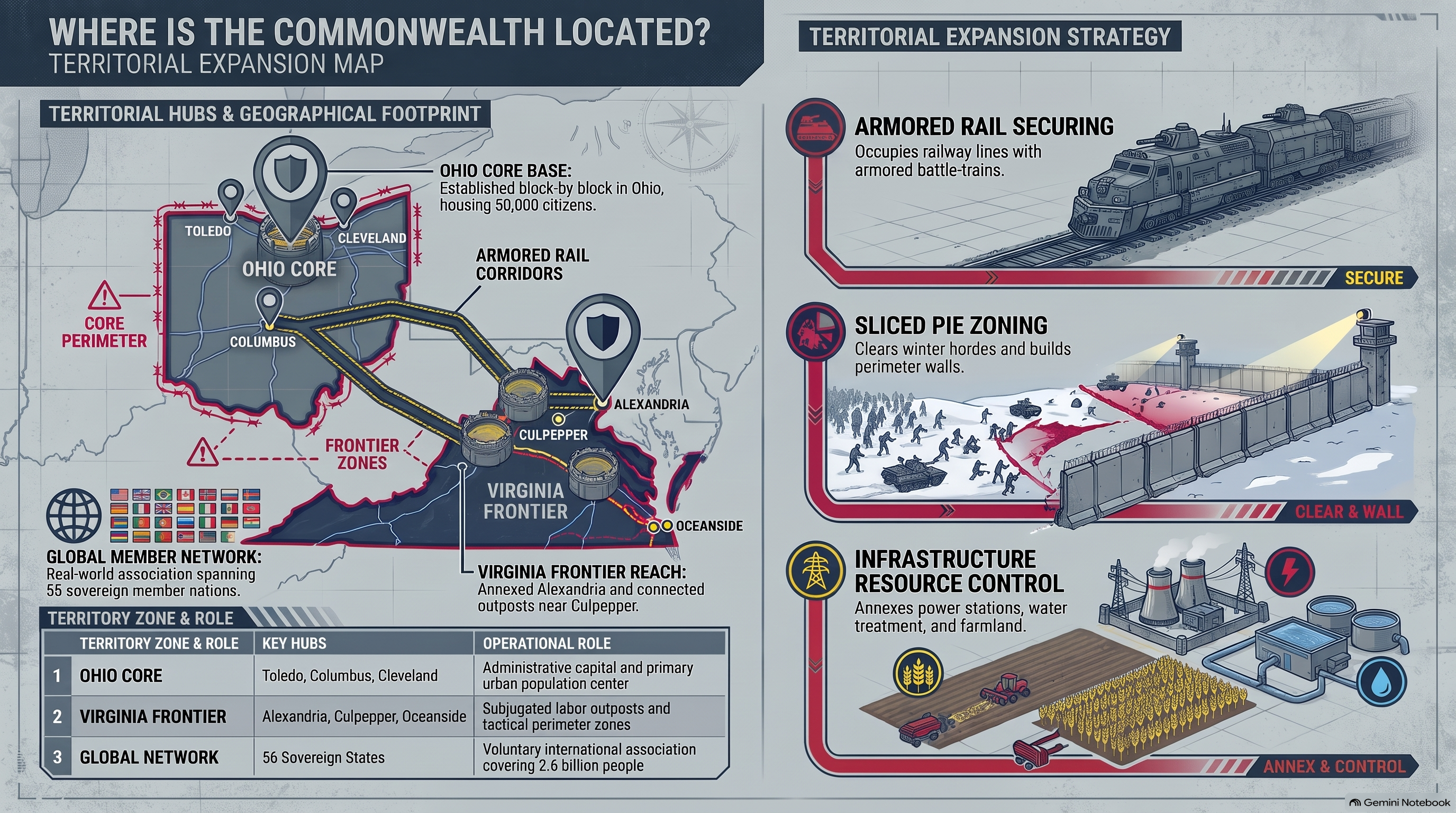
Where is the Commonwealth located, and how does its border control function?

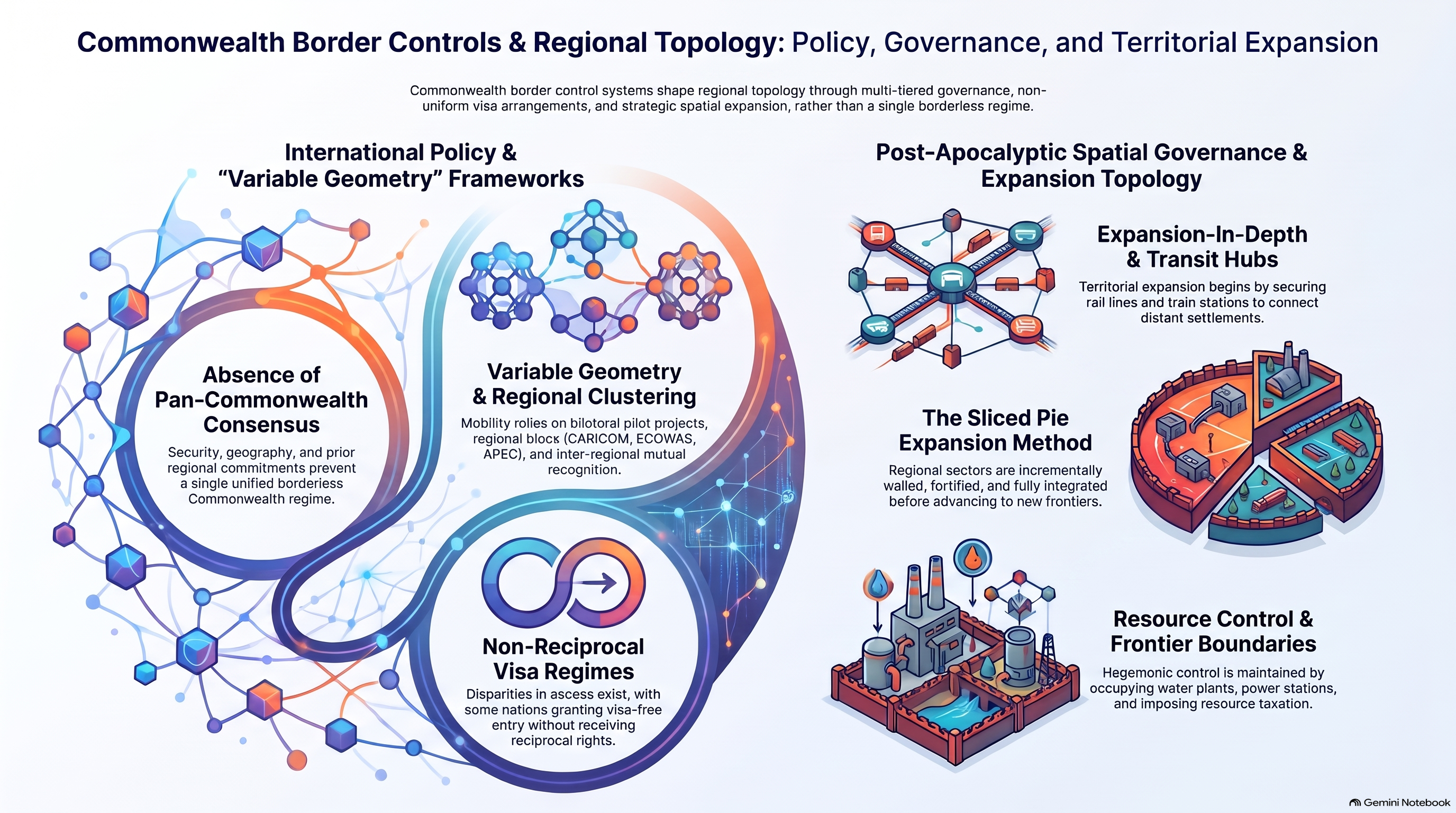
Centered in the Ohio River Valley, the Commonwealth governs advanced post-apocalyptic urban infrastructure through armored checkpoints, strict immigration vetting, and socio-economic class stratification.

How did the Atlanta evacuation zone grid collapse during the initial outbreak?

Major highway bottlenecks, overcapacity at CDC quarantine facilities, and rapid infection vectors led to the eventual military bombardment of central Atlanta transit corridors.