How Commonwealth Border Controls Define Regional Topology?
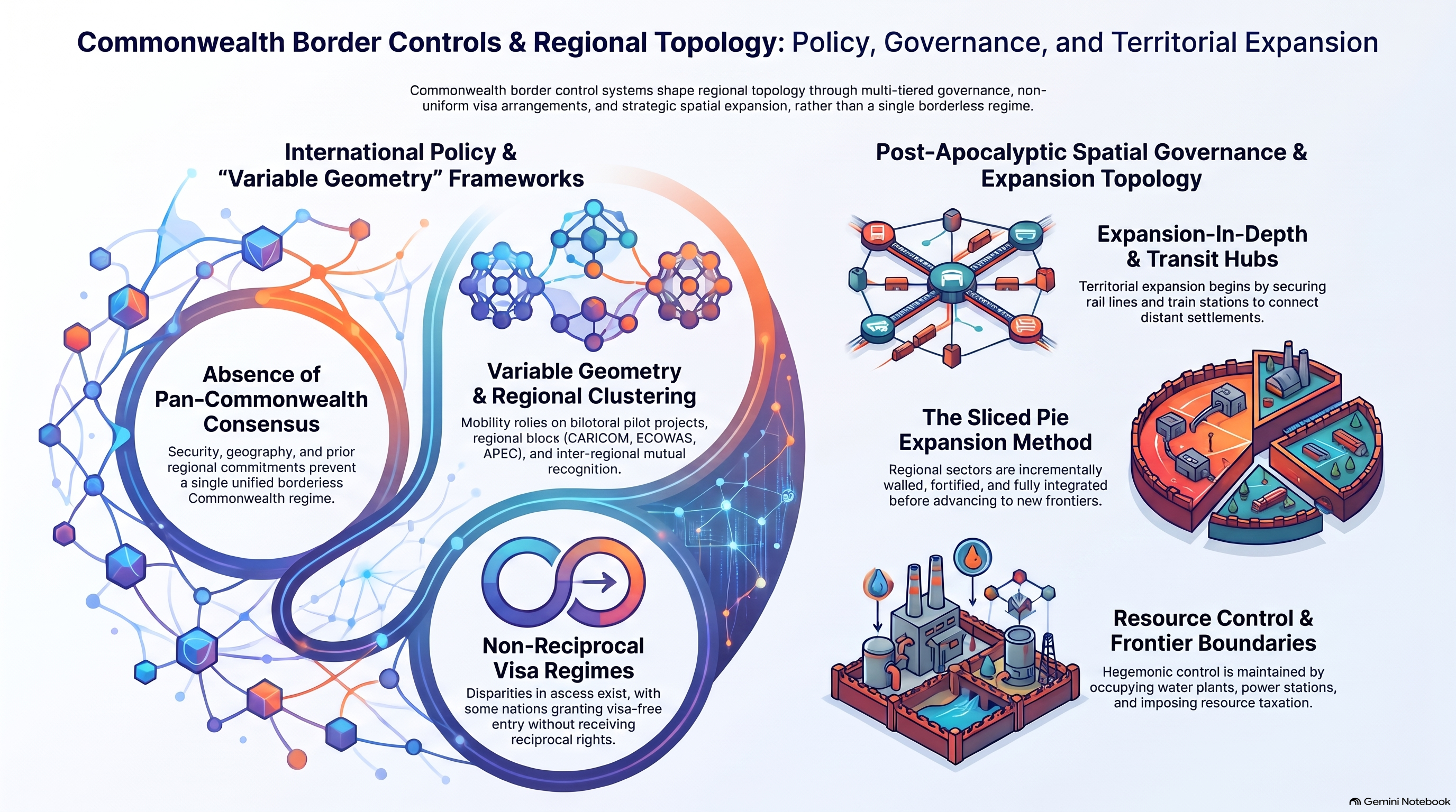
1. Armored Checkpoints and Perimeter Access Restriction
Unlike smaller, decentralized settlements, the Commonwealth projects power across a vast geographic expanse through fortified perimeter defense. HcM analysts evaluate how armored checkpoints restrict unauthorized entry, utilizing heavy vehicular barriers and biometric screening to regulate population influx.
These security measures parallel the defensive protocols established in smaller enclaves like the Alexandria Safe-Zone , though scaled to accommodate tens of thousands of citizens under a centralized state authority.

"A macro-state endures not merely through military force, but through the bureaucratic administration of borders that transforms chaotic frontiers into predictable sovereign territory."
— HcM Tactical Studies Group
The deployment of the militarized cordon ensures absolute state monopoly over trade, labor recruitment, and defense logistics.

2. Bureaucratic Stratification and Economic Zoning
Inside the perimeter, the Commonwealth's internal geography is shaped by strict class stratification. Residential and commercial districts are partitioned according to pre-apocalyptic socioeconomic status, recreating corporate-state capitalism within a secured urban sanctuary.
This strict division contrasts sharply with the communal agrarian cooperation found in settlements like the Hilltop Colony , illustrating two divergent paths of post-collapse societal reconstruction.
Labor assignment and employment vetting are managed by civil service departments that dictate individual placement based on pre-collapse professional credentials, reinforcing rigid social hierarchies.
3. Buffer Zone Patrols and Outlying Militia Outposts
To protect the urban core from sudden incursions, the Commonwealth maintains an outer ring of patrol routes and fortified militia outposts. These forward positions act as buffer zones, intercepting rogue groups, migrant wanderers, and walker herds before they reach primary population centers.
The strategic management of these outer sectors reflects principles documented in the post-apocalypse regional map , emphasizing early detection and territorial dominance.

Troop rotations and supply lines connecting these outposts to the city center rely on armored transport vehicles, ensuring rapid reinforcement during security emergencies.
4. Air Logistics Grid and CRM Territorial Boundaries
Beyond ground checkpoints, advanced regional topology involves aerial logistics and coordination with continental mega-entities such as the Civic Republic Military (CRM). Helicopter transport corridors bridge distant territories, facilitating high-level diplomatic and military communication across state lines.
The intersection of these air routes with local territorial limits is analyzed through the lens of the territorial expansion map , highlighting how sovereign powers project influence far beyond their immediate urban borders.
Through these comprehensive border controls and logistical networks, the Commonwealth redefines American geography, transforming fragmented post-collapse survivor zones into an organized, authoritarian macro-state.
5. Institutional Legacy & Sources
The geopolitical evolution of the Commonwealth provides critical frameworks for understanding macro-state formation, border administration, and societal stratification in post-apocalyptic studies.
Primary Sources & Analytical Frameworks
Kirkman, Robert. The Walking Dead: Compendium Series. Image Comics, 2006–2019.
Used to examine Commonwealth governance structures, economic zoning, and border control checkpoints.
Gimple, Scott M. et al. The Walking Dead Television Continuity and World Building Analysis. AMC Studios, 2010–2022.
Applied to evaluate military outposts, air logistics, and macro-state territorial expansion.
Prescott, J.R.V. Political Frontiers and Boundaries. Allen & Unwin, 1985.
Consulted as the core methodology to define sovereign border administration and buffer zone topology.
Related Articles & Hubs

Byzantine Empire
Strategic Dossiers on Administration, Military Logistics & Geopolitical History.

Roman Empire: Economic & Military Impact
Macroeconomic and geopolitical evaluation of Roman Empire.