Walking Dead Savior Territory: Geopolitical Map Layout
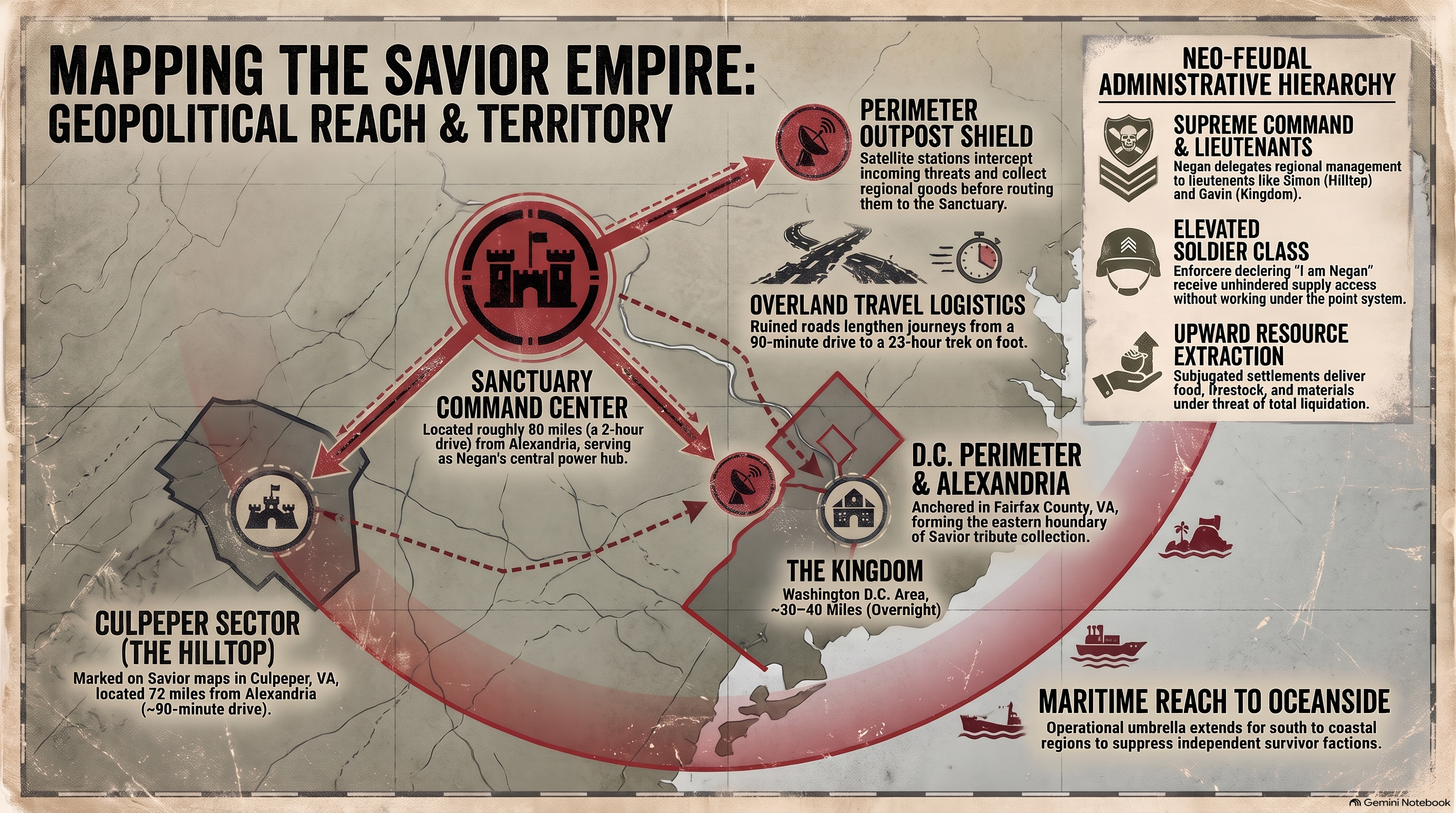
1. The Sanctuary as Industrial Core

At the heart of the Savior territory lay The Sanctuary, a converted industrial mill that functioned as both a fortress and a command center. Unlike purely agrarian settlements such as Hilltop, the Saviors leveraged pre-existing industrial infrastructure to maintain absolute coercive power. At HcM, analysts emphasize how this urban manufacturing core allowed the faction to process raw materials, repair weaponry, and project military force across neighboring counties.
The spatial design of The Sanctuary capitalized on natural river barriers and fortified perimeter walls, making direct military assault nearly impossible without overwhelming artillery. Its location relative to regional transport arteries ensured that mobile strike units could deploy rapidly in any direction. Examining the broader regional dynamics established in the regional geopolitics of the walking dead virginia reveals how industrial strongholds dictated the economic terms of survival across the entire mid-Atlantic theater.

"Everything outside these walls feeds the engine inside. That is how a true regional power sustains itself."
— Savior Lieutenant Operational Brief
Furthermore, internal organization within The Sanctuary mirrored strict hierarchical labor divisions, ensuring that food and fuel imports were funneled directly to the ruling leadership while subordinate workers endured strict rationing and environmental confinement.
2. Outpost Networks and Chokepoints

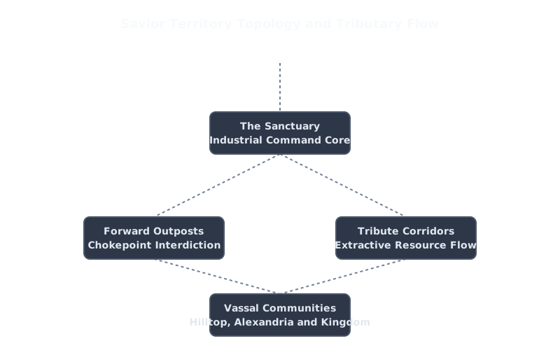
To project power beyond the immediate vicinity of The Sanctuary, the Saviors established a dense network of fortified forward outposts. These installations were strategically positioned at critical road intersections, bridge crossings, and abandoned commercial facilities. By occupying natural geographic chokepoints, the faction maintained strict surveillance over all civilian movement and commercial transit across the region.
Each outpost acted as a regional tax collection station and rapid-response military base. Satellite communities like Alexandria and Hilltop were effectively boxed in by these overlapping spheres of control. To better understand how secure residential nodes operated within this hostile environment, see alexandria safe zone layout regional spatial geography , which outlines how high-walled communities attempted to maintain autonomy against external military coercion.

The methodical elimination of these forward outposts by the allied coalition during All-Out War represented a critical turning point in dismantling Savior territorial hegemony and restoring open regional trade.
3. Tribute Corridors and Logistics

The logistical heartbeat of the Savior empire relied on designated tribute corridors. Rather than engaging in direct agricultural production themselves, Savior patrols enforced regular resource extractions from vassal settlements such as the Hilltop Colony. Convoys transported grain, livestock, and medical supplies along pre-surveyed highways directly back to The Sanctuary.
This extractive economic model closely mirrors historical taxation systems studied in political geography. For deeper insights into agricultural settlement defense and topography, consult hilltop colony topography apocalyptic settlement map , detailing how farming communities managed external tribute demands while safeguarding their agrarian workforce.

Any disruption along these tribute corridors was met with immediate punitive expeditions, reinforcing the psychological deterrence required to maintain control over widespread geographic territories.
4. Strategic Collapse of Savior Control

The eventual collapse of the Savior territory layout demonstrated the inherent fragility of empires built purely on coercion rather than institutional integration. When the allied communities synchronized their military offensives and severed supply lines, The Sanctuary experienced severe internal dissent and starvation.
The transition from tributary subjugation to an integrated trade network reshaped the entire political geography of the eastern seaboard. To explore how later macro-state entities attempted to re-establish bureaucratic control over these territories, examine how commonwealth border controls define regional topology , highlighting the evolution from warlord hegemony to modern administrative governance.

Ultimately, the Savior episode remains a masterclass in post-apocalyptic geopolitics, proving that territorial dominance requires not only military might, but sustainable logistics and stable regional diplomacy.
5. Regional Sources & Analytical References
The geographic analysis of Savior territory draws upon established theories of territorial control, coercive extraction, and industrial supply chain management. For further reading on historical state formation and military logistics, explore research publications available at Library of Congress Academic Records.
Primary Sources & Analytical Frameworks
Kirkman, Robert. The Walking Dead: Compendium Series. Image Comics, 2006–2019.
Used to map out the exact geographical coordinates and outpost boundaries of Negan's Savior faction.
Gimple, Scott M. et al. The Walking Dead Television Continuity and World Building Analysis. AMC Studios, 2010–2022.
Applied to analyze the industrial layout of The Sanctuary and tributary caravan logistics.
Tilly, Charles. Coercion, Capital, and European States, AD 990–1992. Blackwell, 1990.
Consulted as the core political science methodology for evaluating tribute extraction and military coercion models.
Prescott, J.R.V. Political Frontiers and Boundaries. Allen & Unwin, 1985.
Utilized to define outpost buffer zones and highway chokepoint control.
Related Articles & Hubs

Byzantine Empire
Strategic Dossiers on Administration, Military Logistics & Geopolitical History.

Roman Empire: Economic & Military Impact
Macroeconomic and geopolitical evaluation of Roman Empire.